Sweden · Trail running
Höga Kusten Trail
FriluftsByn, Skuleberget, High Coast (Höga Kusten), Ångermanland
Höga Kusten Trail is a two-day trail weekend on the High Coast, a UNESCO World Heritage coast in northern Sweden, with five distances from 14 km to 60 km. Its main race, The Original 45 km, runs through Skuleskogen National Park and finishes on the top of Skuleberget, with 12 hours allowed. It is run in late August with a flying start and a relaxed, social feel, but the terrain is rock and roots, and the places are gone within days of the release.
Official site (opens in a new tab)Joint no. 12 of 41 in the toughness ranking
The race in brief
- Distance
- 45 km
- Format
- The Original 45 km: point to point from Entré Väst in Skuleskogen National Park to the top of Skuleberget, flying start 08:00 to 09:00, 12 hours in total, three energy stations and one cut-off at Entré Syd (km 26)
- When
- Last weekend of August (the 45 km on Saturday 28 August 2027)
- Mid-pack time
- 7 h 21 min (median finisher of the Original 45 km, 2026; middle half 6 h 41 min to 8 h 11 min)
- Cut-off
- Cut-line at Entré Syd (km 26) at 16:00, 7 hours after the first start; 12 hours in total for the 45 km
- Entry fee
- 1 095–1 295 kr (The Original 45 km, 2026 price steps (1 095 kr to 31 March, 1 195 kr April-May, 1 295 kr from June); 2027 prices not yet published)
- Field
- 403 registered and 339 started the 45 km in 2026; 312 finished
- First held
- 2014
- Other distances
- The Original 45 km (Saturday, 12 h) · The Ultimate 60 km (Saturday, 12 h) · Twin Peaks 14 km (Saturday afternoon, 5 h) · Coast to Summits 28/32 km (Friday, 6 h) · 3Peaks 18 km (Friday, 6 h)
- Organiser
- Höga Kusten Trail (FriluftsByn, Höga Kusten)
Next edition: 2027-08-28 · Weekend of 27-28 August 2027 at FriluftsByn. Entries open Friday 5 March 2027 at 15:00 according to the organiser's home page on 2026-10-15 · Entries (opens in a new tab)
Checked 2026-10-15
How tough is it?
Four meters, each 1 to 5, rated by our published method. The basis under each one shows the figures behind the score. How we rate.
Median finishing time 7 h 21 min of the 312 who finished the Original 45 km; middle half 6 h 41 min to 8 h 11 min; fastest 4 h 15 min (Neptron timing archive, Höga Kusten Trail Day 2, August 2026). The organiser gives 12 hours. As of 2026-08.
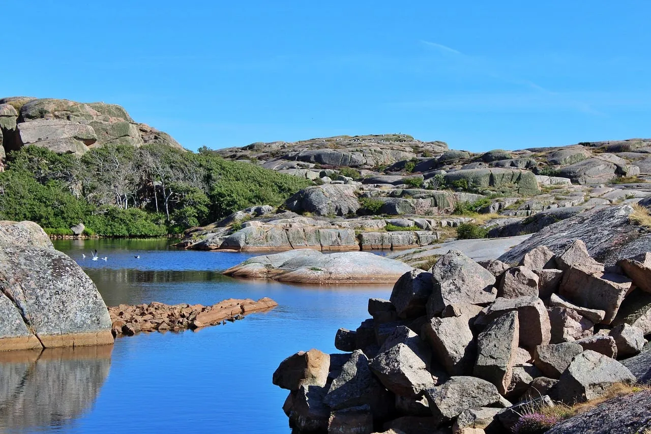
Marked footpaths, granite slabs polished smooth by ice, loose stone and roots, a ravine and several peaks (Stampberget, Slåttdalsberget, Getsvedjeberget), and a very steep finish on Linbanestigen to the top of Skuleberget. About 2.5 km of forest road at the start and 3 km of gravel at km 26. Total ascent not published. Organiser's course description, 2026. As of 2026-08.
A late August race on the Gulf of Bothnia coast. No race-day temperatures were sourced. The organiser requires a windproof jacket, hat, gloves and a long-sleeve base layer for all distances, which points to cool mornings, rain or wind on the tops. Organiser's kit list, 2026. As of 2026-08.
One cut-line at Entré Syd, km 26, at 16:00 (7 h for the first 26 km), 12 h in total. 27 of 339 starters did not finish in 2026 (about 8 percent). Entries are the real hurdle: half the places were gone in a weekend and the organiser says places have sold out every year for 11 years. Organiser and Neptron, 2026. As of 2026-08.
The course
Buses take you from FriluftsByn to the start at Entré Väst, by the E4 near Skuleskogen National Park, and you start any time in the 08:00 to 09:00 window; your own time begins when you cross the line. The first 2.5 km are forest road before the route climbs past Skrattabbortjärnen to Stampberget, then drops into the Slåttdalen valley towards the ravine of Slåttdalsskrevan (closed to entry because of rockfall risk) and Tärnättvattnen. The first energy station is at Tärnättholmarna on the coast, at 15 km.
Stage two loops back inland past Tärnättvattnen and Slåttdalsskrevan a second time, up Slåttdalsberget and down to Kälsviken and Entré Syd, where the second station and the cut-line at 16:00 are at 26 km. Stage three follows the Höga Kusten Trail footpath, with 3 km of gravel road through the village of Käl, over Getsvedjeberget with its Predikstolen viewpoint and under the E4 through a tunnel to Skuleberget Östra, the third station. The last stage climbs the east side of Skuleberget and then drops down to FriluftsByn before the final climb.
The finish is on top of Skuleberget, reached by Linbanestigen, the path beside the cable car. The organiser calls it a family path in normal life, but after about 43 km it is very steep. You can walk or ride the cable car down to the party in FriluftsByn. The organiser's course page is partly outdated (it describes the 2024 changes), so check the briefing the evening before.
How to enter
Places are released in two rounds and go very fast. In 2026 half were released on Friday 27 February and sold out that weekend; the remaining half went on sale on Sunday 15 March at 15:00. For 2027 the organiser's home page says entries open on Friday 5 March 2027 at 15:00. The organiser says places have sold out every time for 11 years. There is no seeding, qualification or licence.
In 2026 the Original 45 km cost 1 095 kr (about EUR 100) to 31 March, 1 195 kr from April to May and 1 295 kr from June; 2027 prices have not been published. The fee covers energy stations, a map, buses from FriluftsByn to the start, timing, first-aid staff, a medal and the after-trail party, and includes a payment to the county board for trail use in the national park and nature reserve. Places cannot be cancelled, even with a doctor's note, unless you add cancellation insurance when you enter (Startklar, 155 kr, or Startklar Plus, 275 kr, 2026). You can transfer your place for a 100 kr service fee, but you cannot defer it or change distance.
How to train for it
Run on rock and roots, not only on gravel
The 45 km is on narrow, technical footpaths with smooth granite slabs, loose stone and tree roots that are slippery when it rains. Do most of your long runs on uneven forest trail and practise walking steep climbs efficiently.
Prepare a hard last 2 km
You finish by climbing the steep Linbanestigen after 43 km. Include hill repeats or long steep walking in the last hour of your long training runs, and have food in reserve for the finish.
Pace the first 26 km against 16:00
The only cut-line is at Entré Syd, 7 hours after the first start. Check in training what pace you hold over 26 km of technical trail, so that you reach the second half with some margin. The median finisher took 7 h 21 min for the whole course.
Plan for two dry stretches
Water is only refilled at the stations and at the stream Skravelbäcken at the end of the first stage. Carry at least 0.5 l (1.5 l is the organiser's suggestion) and drink early on the exposed tops.
Test your shoes on wet rock
Metal studs are banned to protect the trails. Choose shoes with deep rubber lugs that you have already used on wet rock slabs.
What you need
- T-shirt, shorts or tights, running shoes and your bib; metal studs are not allowed.
- A windproof jacket, hat and gloves, and an extra long-sleeve base layer in the pack (used if you are hurt and after the finish on the top of Skuleberget).
- Phone with the race office number saved, a whistle and a headlamp.
- Bandage and elastic wrap for first aid.
- A container for at least 0.5 l of fluid, energy food and sports drink.
- Toilet paper; the toilets on the route are limited and paper can run out.
- Spot checks of mandatory kit are made before, during and after the race, and missing kit means disqualification. Littering means immediate disqualification.
Getting there and staying
FriluftsByn, at the foot of Skuleberget, is the start and the finish area for all distances. The nearest places to get public transport are Örnsköldsvik and Kramfors train stations. Y-bus coaches from Umeå and Stockholm stop at Docksta, about 2 km from FriluftsByn. A flight runs between Arlanda and Örnsköldsvik. The organiser says local transport is limited and recommends a car if you can. Parking next to FriluftsByn costs 50 kr per day. A Trail-Bus from the organiser's partner hotels costs 100 kr return (250 kr for others).
Staying at FriluftsByn is most popular and books early. Cabins for Friday to Sunday were listed at 3 200 to 6 000 kr per cabin in 2026, and a gym-floor sleeping place, Löparkollo, at 400 kr, and tents are on site. Collect your bib on Friday evening for the 45 km, with a briefing and mini-expo that evening. After the finish you go down by cable car or on foot to the after-trail at FriluftsByn with food and live music.
Where to find out more
- Höga Kusten Trail (opens in a new tab): The organiser's site with distances, entry, course descriptions, rules and results.
- Entry and fees (opens in a new tab): Release dates, price steps, cancellation insurance and transfer rules.
- Travel, accommodation and food (opens in a new tab): How to get to FriluftsByn, the Trail-Bus and lodging prices.
- Results 2026 (Neptron timing archive) (opens in a new tab): Official results for the Saturday races, including the 45 km.
Questions about Höga Kusten Trail
How many hours do I have for the 45 km?
Twelve hours in total, with a cut-line at Entré Syd (km 26) at 16:00. The median finisher took 7 h 21 min in 2026 (Neptron, August 2026).
Is there a mass start?
No, it is a flying start: you leave any time between 08:00 and 09:00 and your own clock starts at the line. Buses from FriluftsByn run from 07:30 (organiser, 2026).
How hard is it to get a place?
Very hard. In 2026 half the places sold out in a weekend and the organiser says every edition for 11 years has sold out. The 2027 release is announced for 5 March 2027 at 15:00.
Which other distances are there?
Twin Peaks 14 km (5 h), 3Peaks 18 km (6 h), Coast to Summits 28/32 km (6 h) and The Ultimate 60 km (12 h). The 14 km runs Saturday afternoon, 18 km and 28 km on Friday.
Can I walk it?
Yes. The organiser describes the event as for runners and fast walkers, and the 12-hour limit allows long periods of walking. Remember the 16:00 cut-line at km 26.
Similar races
Sweden · Trail
Lidingöloppet
Lidingö, Stockholm
30 kmLast weekend of September; the 30 km is on the Saturday (25 September 2027)

Norway · Trail
Tromsø Mountain Challenge
Tromsdalen, Tromsø, Troms
50 kmSaturday and Sunday in the third week of August (21–22 August 2027)

Finland · Trail
Vaarojen Maraton
Koli National Park, North Karelia
43 kmFirst weekend of October (Friday evening ultra start, Saturday for the other distances)

Norway · Trail
Stoltzekleiven Opp
Stoltzekleiven, Sandviksfjellet, Bergen
0.9 kmFriday and Saturday in the last week of September (25–26 September 2026; the 2027 dates were not yet announced in October 2026)
Sources
Figures and rules on this page come from these pages, read on the dates given. Organisers change dates, fees and rules: check the official site before you enter.
- Höga Kusten Trail home page (2027 dates, release) (opens in a new tab) (read 2026-10-15)
- The Original 45k (organiser) (opens in a new tab) (read 2026-10-15)
- Entry and fees (organiser) (opens in a new tab) (read 2026-10-15)
- Rules and safety (organiser) (opens in a new tab) (read 2026-10-15)
- Course description, Original 45k (organiser) (opens in a new tab) (read 2026-10-15)
- Mandatory kit (organiser) (opens in a new tab) (read 2026-10-15)
- Travel, accommodation and food (organiser) (opens in a new tab) (read 2026-10-15)
- Guide for first-timers (organiser) (opens in a new tab) (read 2026-10-15)
- Race programme (organiser) (opens in a new tab) (read 2026-10-15)
- The Ultimate 60k, Coast to Summits, 3Peaks, Twin Peaks (organiser distance pages) (opens in a new tab) (read 2026-10-15)
- Results Höga Kusten Trail Day 2, 2026 (Neptron archive; median calculated from the 312 finishers) (opens in a new tab) (read 2026-10-15)